

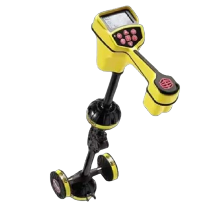
LMX200 Ground Penetrating Radar (GPR) from Radiodetection
$3,000.00
Description
The LMX200 Ground Penetrating Radar (GPR) from Radiodetection is a professional-grade device specifically engineered to locate non-metallic pipelines and other subsurface utilities. It is an upgrade to the LMX100, offering advanced features like grid scanning, improved data visualization, and enhanced mapping capabilities.
Key features
- Ultra-wideband (UWB) antenna: A patented 250 MHz antenna provides a balance of depth penetration (up to 8 m or 26 ft) and high resolution, allowing it to detect a wide range of shallow and deep targets.
- DynaT™ technology: This feature enhances the visibility of targets by automatically optimizing data quality based on system speed. It can be adjusted to focus on small, medium, or large subsurface objects.
- Intuitive display: An 8.0-inch resistive touchscreen is designed for use even while wearing gloves and supports multiple languages.
- Advanced mapping: The LMX200 features a built-in GPS and can be integrated with an external GPS for higher accuracy. It supports:
- Grid Scan: Collects data systematically to generate 3D depth slices in the field.
- SplitView and MapView: Visualizes the survey path in real-time and allows on-site review of data and interpretations.
- Data transfer and reporting: Data can be exported via USB or Wi-Fi to a computer for further analysis using optional EKKO_Project software. Geo-referenced KMZ files can be generated for viewing in Google Earth.
- Robust design: A lightweight fiberglass cart frame ensures portability and prevents interference with the GPR signal. The unit has an IP65 rating for protection against dust and water.
- Swappable battery: A long-lasting, swappable lead-acid gel battery ensures extended field use.
Target detection
The LMX200 is particularly effective at locating objects that conventional electromagnetic locators cannot find. This includes:
- Non-metallic pipes made from PVC, clay, and asbestos cement.
- Concrete storm and sewer systems.
- Underground storage tanks, septic systems, and drainage tiles.
- Undocumented utilities and buried cables.
- Trenches and areas of disturbed soil.
- Non-utility structures like vaults, foundations, and concrete pads.
Primary applications
- Private utility locating: Essential for mapping utilities on private property where public records may not be available.
- Subsurface utility engineering (SUE): Provides detailed information for infrastructure planning and pre-excavation analysis.
- Civil engineering and construction: Prevents damage to buried assets by locating them before excavation.
- Environmental assessments: Used for investigating areas like landfills and industrial sites.
- Forensic and law enforcement: Detects buried evidence by locating both metallic and non-metallic objects.
Reviews (0)
Only logged in customers who have purchased this product may leave a review.
Shipping & Delivery


Reviews
There are no reviews yet.